

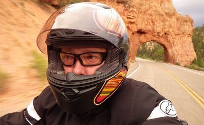
More Important Than the Destination: A Return Journey From Sturgis
The long journey home


Within Wyoming lies some of America’s finest roads and scenery. As home to both the first National Park in our system as well as the landmark made famous as a hidden spaceport in the 1970’s classic Close Encounter, Devil’s Tower. Mountain peaks to grassy plains, cowboys to Indians, this state is quite remarkable and worthy of a circumnavigation tour before heading South to home.
Day 1: Sturgis to Sheridan, WY: 220 miles
The first day on the road south is an easy one, by design, as I know I’m still recovering from some long days and crazy nights in Sturgis. From the Buffalo Chip Crossroads to Sheridan, 250 miles of chore-work pass by as I reminisce about the week I left behind. Did I really eat that? Where did I leave my hat? Did I really get whipped by a chick in exchange for a cigarette?
Day 2: Sheridan to Cody, WY: 150 miles
The second day south is much more inspiring, and with my cameras in tow, I begin channeling Ansel Adams right away.

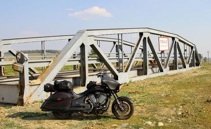
Departing downtown Sheridan, the maps lead one to believe route 330/Keystone Road connects through to the main westward mountain route of 14, and it does. What you don’t know, it’s a paved/gravel road until you get there. Luckily, it’s pretty solid, but with some occasional gravel so if you’re shaky off-road, go around. Hop on the freeway and exit again in Ranchester to begin the journey west though Dayton and up over the Hogback.
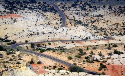
The Bighorn Scenic Byway (Route 14) climbs over redrock ridge lines and crosses the forests of North Central Wyoming, passing through Greybull on its way to the gateway to Yellowstone National Park, Cody.
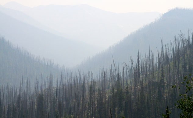
Climbing the initial grade into the Bighorn National Forest, the sweepers are idyllic and clean, but I’m being hunted by thunderstorms as I climb into the cold and scenic forests, so I don’t explore too much; just ride.
Summiting 8,000 feet before spliting with 14-ALT (which passes through Lovell instead of Greybull before reaching Cody), I take the southern fork and pass through Greybull instead. The Shell Falls Visitor Center on the western slope makes for a good break and photo spot.
Routes 16 and 20 join the 14 for the next leg to Cody. This straight-line highway looks a bit like the eastern part of Wyoming mixed with the Mojave desert: straight and flat grasslands and cornfields baking in the sun.
Passing through the heart of Greybull I have no problem following a safe speed through town… 45, 30, even 20 mph, but when there’s a straight line across the open plain, a 65 mph sign post, and the locals are passing me, I tend turn it up a notch. I’ve booked an awesome cabin outside of town, peacefully seated along the Shoshone river.
Day 3: Cody to Jackson, WY: 180 miles
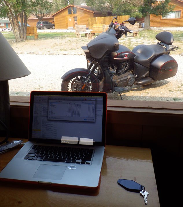
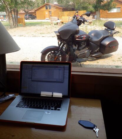
Tuesday started out the on the wrong side of the bed. Having set my alarm for 8am, I woke at 10 and managed to sweet talk my way into a plate of food from the breakfast buffet while they cleared it away. I returned to my room to complete my first story uploads from the rally and pack up before the 11am check out. Wanting to be gone already and exploring Cody, ultimately hoping to enter into Yellowstone early and maybe reach the Tetons before sunset. That plan went to hell when I lost the key to my motorcycle and 90-minutes later, I finally found it under the unused bed in the cabin.
I was only 30 miles from the park, so getting there was easier than I expected after a morning like that. With antler art in nearly every front yard along the Buffalo Bill Cody Scenic Byway, I truly knew I was in Wyoming’s backcountry. Entry fee is $25 for both Yellowstone and Grand Teton National Parks, but motorcycles get a deal for $20. Hooray for two wheels!
Inside the park boundary the roadway still carries Route numbers 14, 16 and 20 all the way around Yellowstone Lake until it crosses the Continental Divide and connects with Route 89 on the western shore.

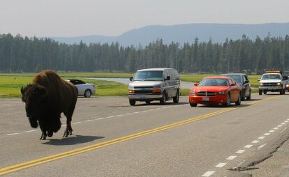
After a few buffalo sightings, some in the fields off to the side, others actually in the road and blocking traffic, it’s time for a stop at the Old Faithful geyser. Luckily again, my stop was timed well with its naturally timed release… arriving just in time to park, grab my camera and a sandwich to eat during the show. The mass exiting of traffic at that moment however didn’t help my progress on the day’s mileage.
Getting late in the day thanks to the late start, I did manage to see the Grand Prismatic Spring farther north before backtracking 20 miles en route to my hotel in Jackson but what a let down! Choose the wrong path to see this natural wonder and you won’t get the aerial view we all see in the postcards. Only when you start at the parking lot south of the more popular trailhead parking will you get that view.
By the time I make it down to the Grand Teton National Park border, the sun is setting over beautiful Jackson Lake. Someone should have told me to skip Yellowstone and it’s tourists and head straight to the Tetons!
Realizing I really need to see this in better light, I had no choice but to stay the night in the high-dollar summer/winter resort town of Jackson. Famous for an elk reserve, alpine skiing and Jackson’s Hole (whatever that might be), its another late night of frozen dinners and photo downloads. Here’s to a smoother departure tomorrow!
Day 4: Jackson to Teton return to Price: 400 miles
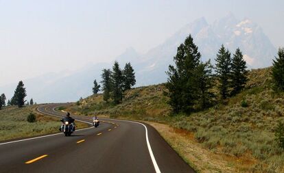
Cruising through the Tetons afforded barely any better light than the night before for photography, but I got to see the rocky peaks and take a few photos before racing off to Utah and ultimately home. I take a stroll around Jackson’s town square to find free wifi, family picnics, calf-roping tweens, art galleries, and tons of “western” atmosphere. This place will go on my “return to someday” list. Wyoming is wonderful, but I’m starting to feel the pull towards home now.

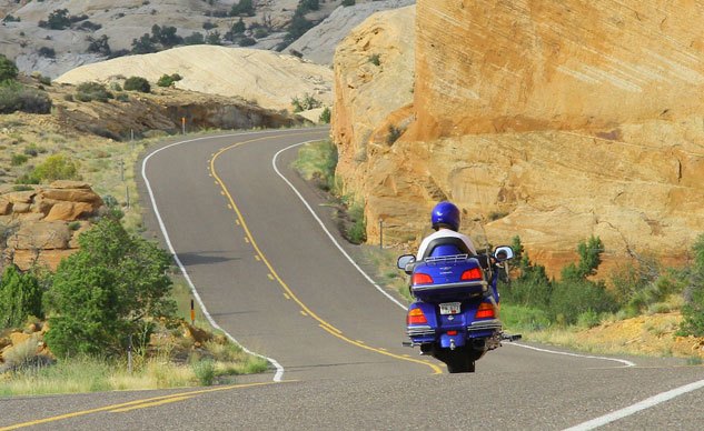
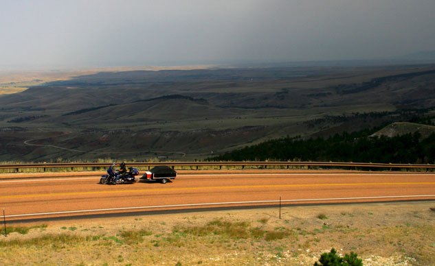
From there, gravity takes hold of the Victory motorcycle and starts pulling me towards home across high plains and eventually the canyonlands of Utah, along Route 191 and the Wyoming Centennial Scenic Byway. And while the sun sets again over the bleak and dry landscape just north of the Utah border, days seems to go by faster and faster as I break for a roadside meal to fuel me up for another night shift on the bike. Tonight’s midnight ride ends deep in Price, Utah.

While I hope to ride though Moab, the journey around the Grand Canyon would surely add another day to the tour and I have to get back for a photoshoot on Sunday. A brochure I picked up somewhere along the way however, highlights a Scenic Route 12 nestled between Capitol Reef and Bryce Canyon National Parks and added exactly the right amount of backroads before I agree to riding the superslab home. The wandering continues!
Day 5: Price to Cedar City, UT: 460 miles
Todays ride starts with a bath for the motorcycle and me. And as the landscape turns back to the familiar flat tan and sagebrush along Route 10 south out of Price, straight lines are broken up with a climb into Utah’s Panoramaland and the Manti-La Sal National Forest before crossing I-70 and picking up Route 72. A soaking rain also joins the tour (of course!) and returns the bike back to its crusty state.
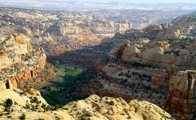
Route 72 travels south along the line between a national forest and a national park, t-boning Route 24 in Loa, less than 20 miles from a western entry point to the Capital Reef National Park and starting point for the scenic Route 12 in Torrey, Utah.
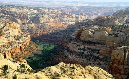
From here you can spend a lifetime hiking, fishing and enjoying the “elevated life” of Utah, surrounded by a dozen named national and state parks: Escalate, Kodachrome Basin State Park, Bryce Canyon – to name a few. Riding the gaps between Capital Reef and Canyonlands National parks, and still not willing to ride all the way around the Grand Canyon, I finally steer west towards the major artery South, the 15 freeway, over more winding and scenic routes.
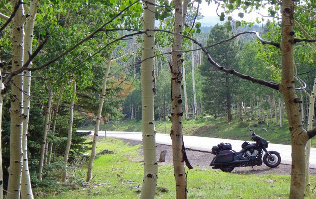
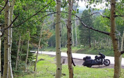
The hill climb through the birch forest of Dixie National Forest brings cooler temps and a crest of nearly 10,000-feet before reaching the town of Escalate. Canyons and forests mingle for a while, offering far too many places to stop and look around. And like water carving downhill between walls of red sandstone and man-made tunnels, at the western border of Dixie National Forest I connect again with Route 89 between Panguitch and Hatch. I push on through the night, through thundershowers and road construction along Routes 143,148 and 14 to Cedar City.

Day 6: Cedar City to Los Angeles, CA: 460 miles
A morning in Cedar City welcomes me back to the oppressive heat and congestion of the civilized world. While I’m still 175 miles north of Las Vegas the end is far too near! From here on out the roadside attractions include less natural landmarks and vistas and more crap like burning semis, casinos and traffic. One last glowing orange California sunset saves the day from complete disaster. The end however, comes just 100 miles or more from this point, where a beer and a real bed awaits me.

All told, the ride home from Sturgis this time took me six days and more than 1,700 miles. Scenic yet tough, riding with me isn’t always fun, but its an adventure you won’t forget. If you get the chance to ride around the old west for a few weeks, take it. For me, it was a journey told in nearly 5,000 words and more than 20,000 photographs. You’ll shoot a few less photos than I did, but your story will be the same – epic!
More by Alfonse Palaima


Comments
Join the conversation